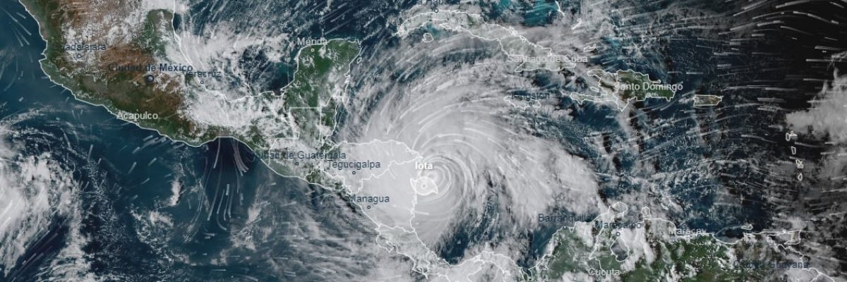
Hurricane Iota has hit Central American countries in recent days and is shattering climate records. This is the 30th hurricane to hit this year. Only powerful storms with high winds and large amounts of precipitation are named and Iota is definitely one of those. 2020 in its own right is a record breaking year, not only in the number of storms but also in their intensity. Hurricane Iota, the strongest atlantic hurricane of 2020, was a Category 5 hurricane when making landfall in the Nicaraguan and Honduran regions, and it comes just 13 days after another powerful Category 4 hurricane, ETA, hit the same area. Category 5, is the highest of the categories on the Saffir-Simpson wind scale and indicates wind speeds of over 250 mph.
Hurricane IOTA is not only unique in its intensity, also unique for its timing –hitting this late in the year. The hurricane season usually ends around October, when the ocean waters begin to cool. We are in mid-November and intense storms are still brewing and making land fall. Another storm is already on the horizon, making its way to the same area and projected to hit this week, expected to reach a 3-4 on the Saffir-Simpson scale.
The storm, like its predecessor, is expected to inundate large areas, causing massive floods, mudslides, extensive destruction along with many casualties. It will include tidal waves measured at 15 meters and winds that will severely damage the dilapidated buildings that characterize the area’s residential zones. In the next two days it is expected to weaken to a strength 3 when it reaches El Salvador. At the same time, another tropical storm is developing in the Indian Ocean (ALICA), so even though we are entering the colder winter period, there are still storms to anticipate.
And finally, the question must be asked – why are we encountering this phenomenon of intense storms arriving in increasing numbers? I think the answer to that is clear – climate change.


