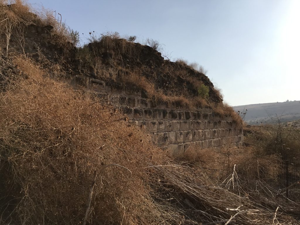
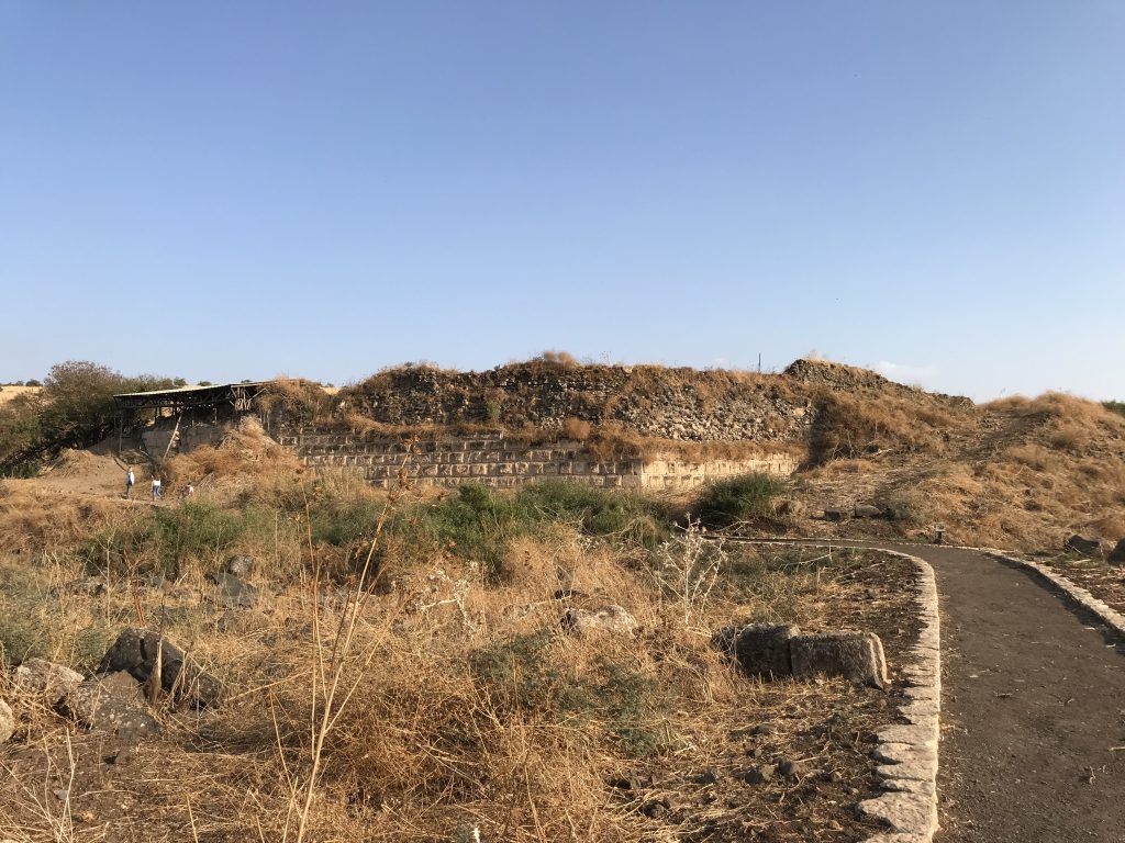
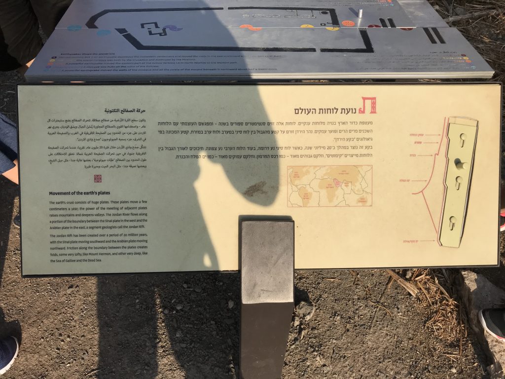
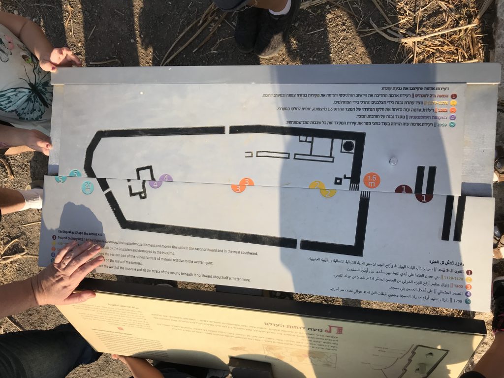
Following you can see a Crusader fortress built in the 12th century near the banks of the Jordan River, in what today is Israel. It was built in order to secure a ford across the river. The fort was completely destroyed a few years after it was erected. Amazingly, the fortress was erected just above a geological fault (Dead Sea fault AKA the Syrian African rift / the Great Rift Valley), whose geological-seismic activity sliced it down the middle and shifted laterally the blocks on either side by two meters.
While the fortress’s eastern side moved north with the Arabian Plate, its western side moved south west (with the Sinai Block on the African continent). Thus far, the sides have moved over 2 meters since the fort’s erection. A mosque that was built on top of the fort during the Muslim occupation has since also been split in two. The rapid displacement is attributed to two or three earthquakes that occurred at the site: 1202 CE and 1759 CE. Today, the fort helps to measure the rate of movement of tectonic plates in the area.
The site, was excavated by an interdisciplinary team from the Hebrew University of Jerusalem, Tel Aviv University, the Geological Survey of Israel, Israel Antiquity Authority.
The name of the place: `Ateret`.
- Peer review by Pro. Amotz Agnon, Hebrew University of Jerusalem
Photos by Maor Kohn